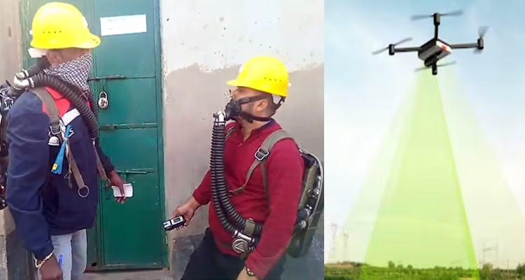
Dhanbad: With the Kenduadih gas leak showing no signs of easing even after nine days, experts from the Central Mine Planning and Design Institute (CMPDI) have begun an extensive drone-based survey to map the affected zone and identify the source of the underground emissions.
A CMPDI team led by Geology Manager Bhuvnesh Kumar Gupta arrived from Ranchi on Thursday and immediately started aerial measurements using a high-resolution drone camera. The team is tracking temperature variations, population spread, and housing patterns across the leak zone — key indicators that help determine the intensity and movement of the trapped gas.
Gupta said that since winter temperatures typically range between 20°C and 22°C, any hotspot detected above normal would strongly suggest an active gas pocket. “These readings will be taken repeatedly for accuracy, and a detailed report will be ready in 15 to 20 days,” he said.
Despite continuous monitoring, officials admit the situation remains alarming. Toxic gas levels in several pockets are still far above safe limits, raising concerns for both residents and the administration. Multi-agency teams, including experts from DGMS, CIMFR, CMPDI, and other scientific bodies, are using all available methods to identify the root cause of the leak.
Meanwhile, the investigation and mapping work is moving at a rapid pace, even as the prolonged emission continues to test the preparedness of local authorities. With gas levels remaining high and the source still unclear, officials say the incident remains a serious and evolving crisis for Dhanbad’s Kenduadih region.